Hotham and Williams
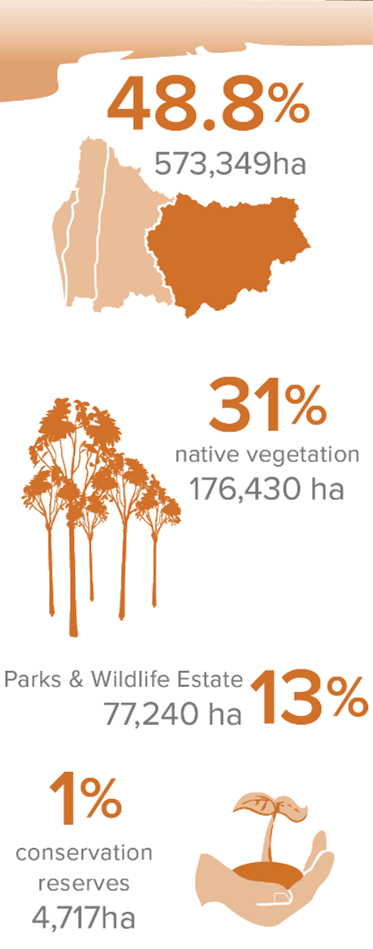
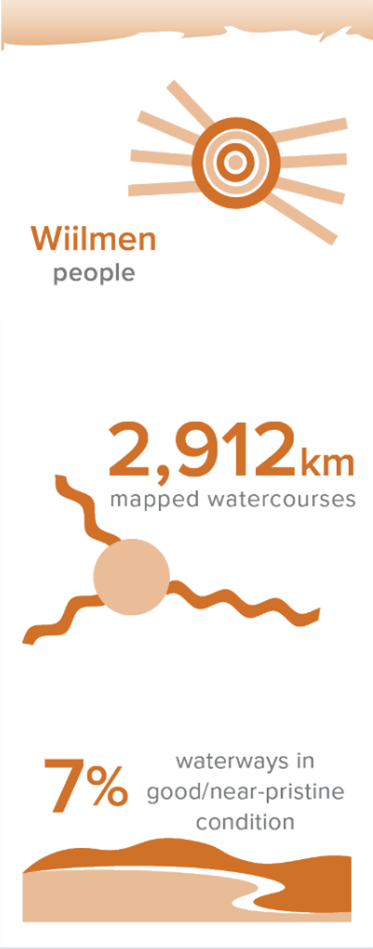
The Hotham-Williams Catchment is a 573,349 hectare area 130km south of Perth linking the Wheatbelt to the Jarrah Forests of the Darling Range and includes the districts of Boddington, Wandering, Williams and Cuballing. Both the Hotham and Williams Rivers were once freshwater but are now brackish or saline due to historic clearing.
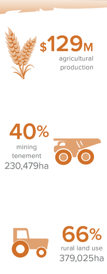
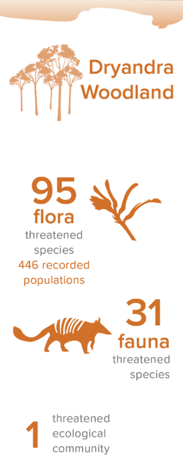
The Catchment includes the Dryandra Woodland, one of the most significant conservation areas remaining in the Wheatbelt. Dryandra is home to 10 threatened species of fauna, including the largest population of the state’s faunal emblem, the Numbat. The main land uses are broadscale cropping and grazing (76%), state forest and conservation (13%), mining, townsites and rural living areas.
Together, the catchments form the highest and geologically oldest part of the Region. They are characterised by rolling hills, steepest close to the jarrah forest, and becoming more gentle before flattening out towards the top of the catchment. Small areas of lateritic remnants with breakaways also occur.
Areas are used for mining, including the Newmont Boddington Goldmine and South 32’s Worsely Alumina operations at Marradong. Around 31% of the subregion is vegetated, with the largest areas of native vegetation being Dryandra Woodland and areas of forest in the west.

Landcare in the Hotham-Williams
Landcare and NRM has been a big part of the Hotham-Williams Catchment since the 1990’s. Programs such as the Western Power Greening Challenge in the Hotham River Catchment have resulted in significant landscape scale change and have started to improve water quality in some local sub-catchments. Fencing of riverbanks has prevented erosion and encouraged natural regeneration. Feral animal control of pigs, foxes and cats has achieved improved environments for stock and native fauna. Management of Dryandra Woodland and threatened fauna such as the Numbat and Woylie are conserving rare and endangered species which have become extinct in other parts of the Wheatbelt
Community Aspirations – Hotham Williams Plan
Building on nearly three decades of landcare and Natural Resource Management in the Hotham-Williams Catchment, the community has prepared an NRM Plan to guide initiatives and projects for the coming decade. Our Hotham-Williams NRM Plan was developed with the Hotham-Williams community and aims to inspire a new generation of landcarers in the Catchment. From Cuballing in the east, to Boddington in the west, all landholders, government and non-government groups, schools and businesses are encouraged to get involved in managing the catchment’s natural resources.
Priority areas identified by the community are listed below:
• Healthy, productive soils and farmlands
• Restored rivers, creeks and valleys
• Biodiversity, native vegetation & habitats
• Community and cultural values
• Community involvement in NRM
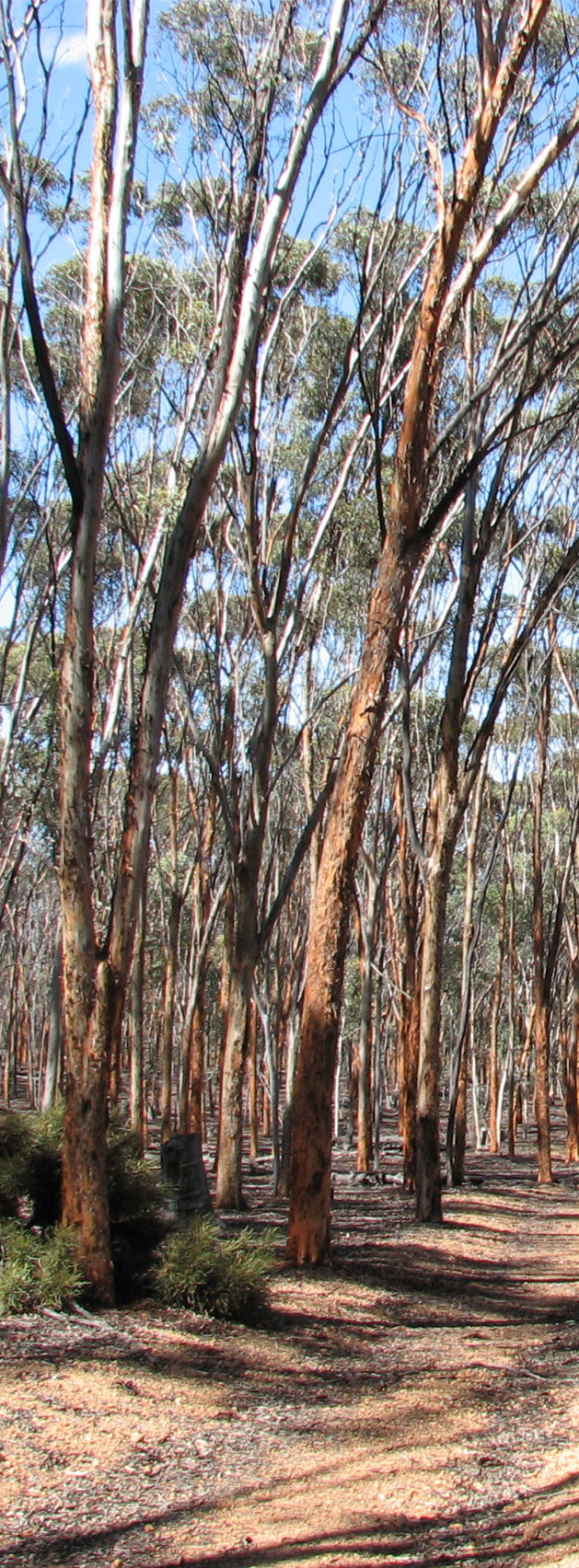
Dryandra Woodland
Dryandra Woodland is one of the most significant conservation areas remaining in the Western Australian wheatbelt. It is made up of seventeen discrete blocks of vegetation in public ownership totalling 28 066 ha. Key values are:
- habitat for ten (10) threatened species of fauna, and two (2) in need of special protection
- twelve (12) vegetation associations, of over 800 native species, including one (1) rare and eight (8) priority species
- extreme diverse flora and fauna due to Dryandra’s transitional location between the arid zone and the wetter environment to the west and southwest
- significant recreation and tourism opportunities.
Dryandra supports populations of several marsupials that have disappeared from most of the Australian or Western Australian mainland including numbat, woylie, tammar (Macropus eugenii), red-tailed phascogale (Phascogale calura) and brushtail possum (Trichosurus vulpecula).
A small timber industry, based on mallee plantations, exists within the Dryandra Woodland. Plantations were established over 50 years from the mid-1920’s to develop a tannin industry. They are important historically, and provide an ongoing resource for small sawlogs.
The challenge remains to manage Dryandra as part of an extensively cleared rural landscape in cooperation with its neighbours. Key issues are the management of feral animals such as foxes and cats, and the connections of the Woodland to other areas of remnant vegetation and nature reserves such as Tutanning Nature Reserve and Lake Toolibin.
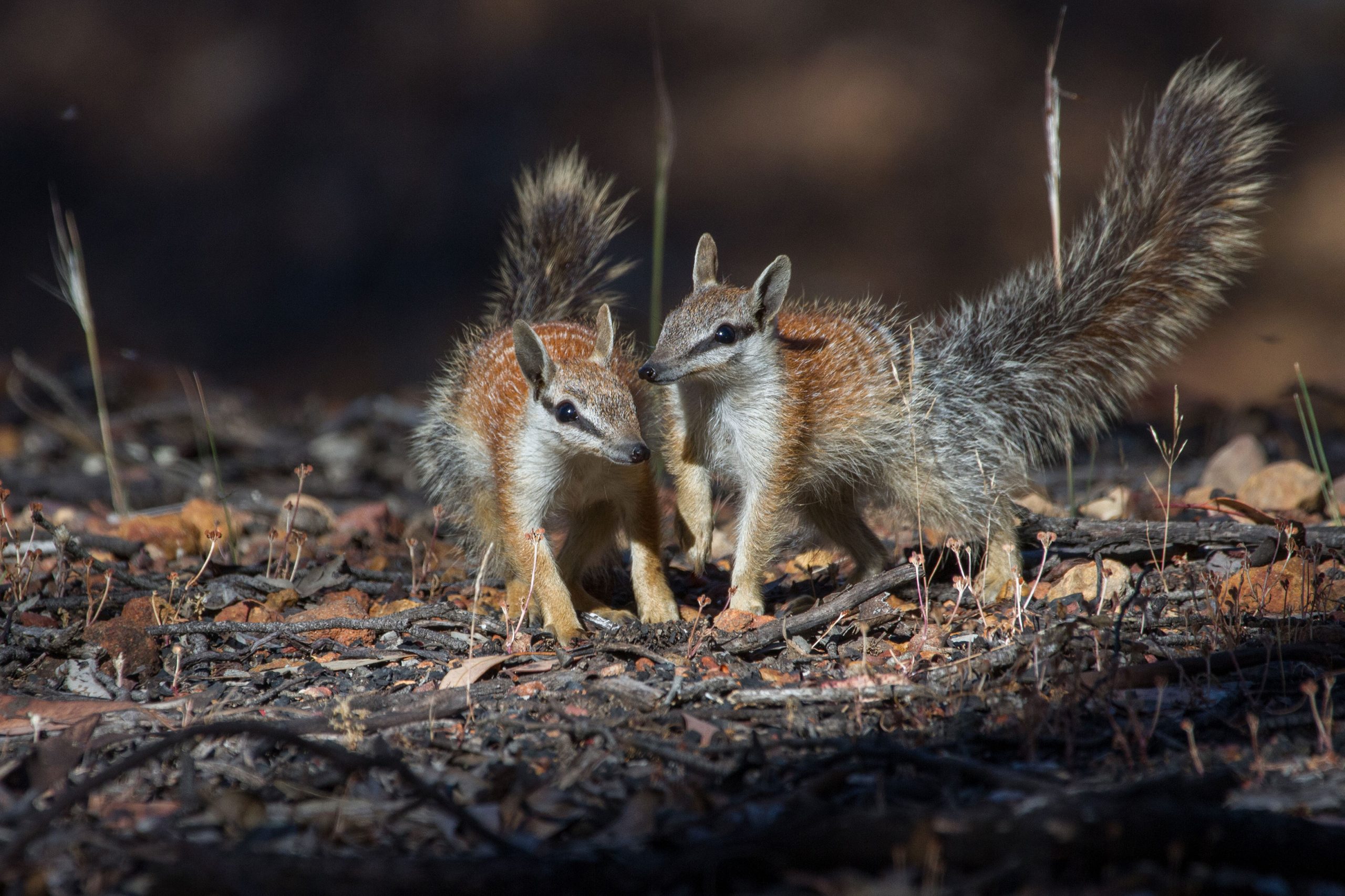
Numbat
Myrmecobius fasciatus
Photo: John Lawson
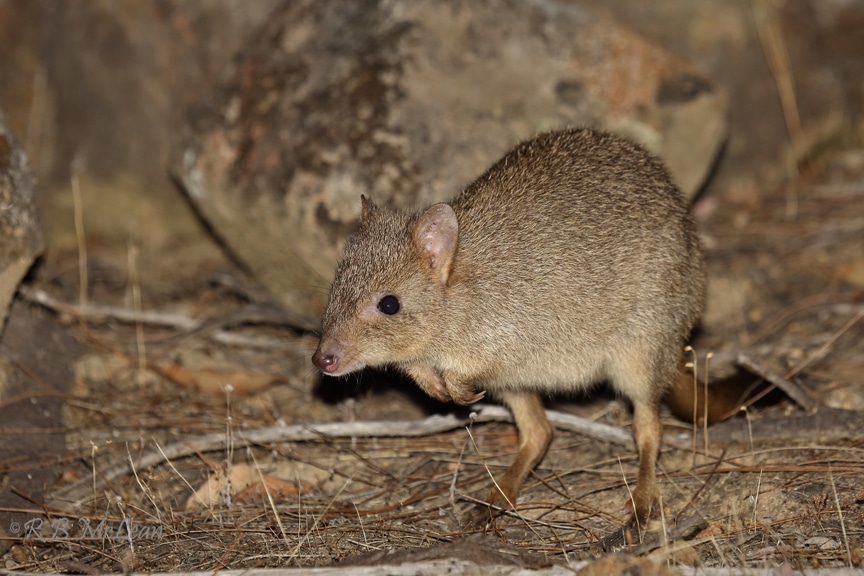
Woylie
Bettongia penicillata
Photo: Roy McLean
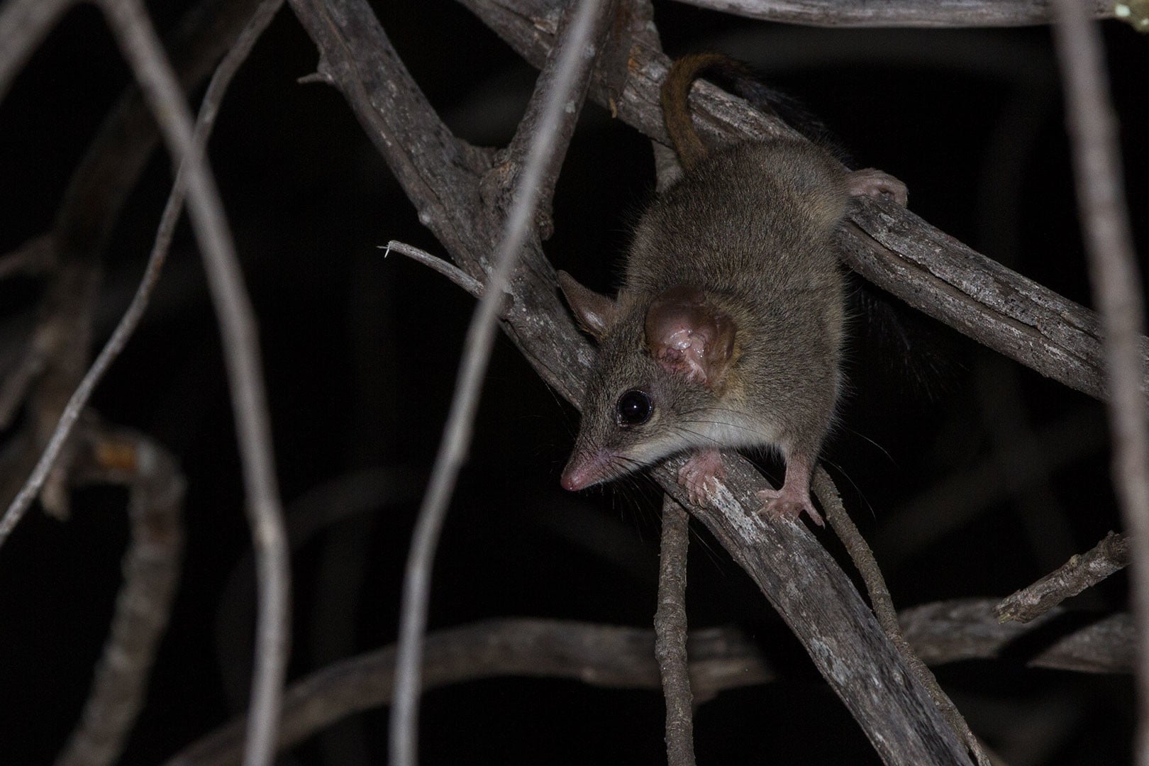
Red-tailed Phascogale
Phascogale calura
Photo: John Lawson
Agricultural Production
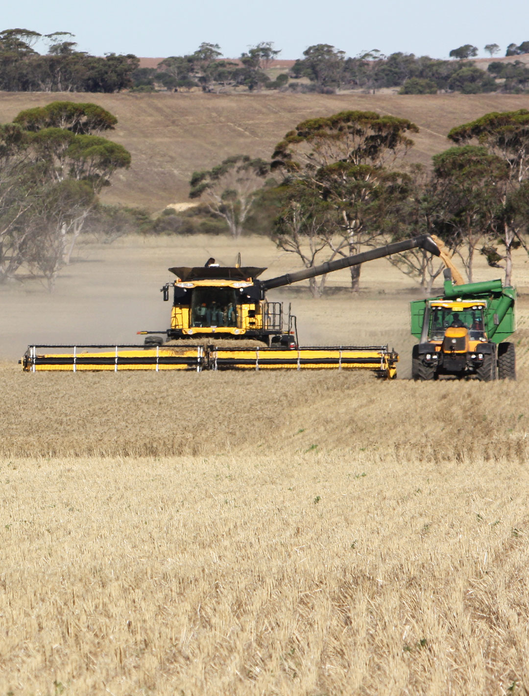
Agricultural production, mainly cereal cropping from this part of the Region, is valued at $129.3 million per annum, making the districts of Wandering, Williams and Cuballing some of the most productive parts of the wheatbelt. This high level of productivity is due to adequate and reliable rainfall (between 500–600 mm) and variety of suitable soil types. However, climate change is impacting on rainfall and water availability and storage is becoming more of a challenge.
Maintenance of soil health is a significant issue for this part of the Region. Dryland salinity, soil fertility, soil acidification and compaction are all important considerations for farmers and NRM. Greater issues relate to the social and economic aspects of modern farming in the wheatbelt including the costs of inputs, farm size and succession planning. These compound NRM issues such as climate variability and soil condition.
Revegetation of large areas of farmland has occurred through programs such as Western Power’s Greening Challenge and oil mallee plantings. Future revegetation with woody species may be targeted to address specific land management issues such as salinization.
The local communities have a long and proud history of Landcare. Community groups such as the Hotham-Williams Catchments Environmental Alliance provide new opportunities into the future. A greater presence by the PHCC in the upper catchment since 2015 is providing more support and smaller groups are becoming reinvigorated and farmers and land managers are again committing to NRM in this beautiful part of our catchment.
Statistical Snapshot
For a detailed comparison of current statistics (2020) to previous (2014) click here
