| B1 |
WETLANDS AND WATERWAYS ARE HEALTHY AND PRODUCTIVE |
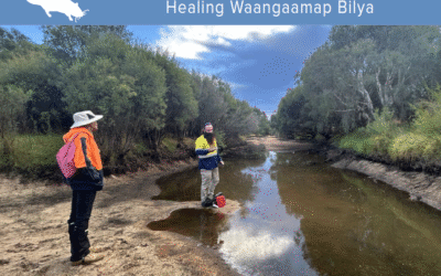
| Wetlands and waterways have a special place, with all major townsites and communities living in proximity to a local waterway or wetland. Major waterway assets include the Hotham, Williams, Murray, Serpentine, North and South Dandalup and Harvey rivers. Major wetland assets include the Peel-Harvey Estuarine System and the Peel-Yalgorup Ramsar System. Key threats include poorly planned development, changing hydroperiods, reduced flow, eutrophication, ASS and MBO. Strategies to achieve this goal are designed to support coordinated management of the Estuary and Ramsar System, implement management actions to improve waterway and wetland condition, and protect groundwater quality and flows into wetlands and waterways. |
| B1.1 |
Support the establishment and operations of coordinated governance frameworks for the Peel-Yalgorup Ramsar System |
| B1.1.1 |
Work with key stakeholders to establish and operate a coordinated framework for the Peel-Harvey Estuarine System |
| B1.1.2 |
Continue to work with key stakeholders to operate a coordinated framework for the Peel-Yalgorup Ramsar System, including but not limited to the Ramsar and subsidiary TAG’s |
| B1.2 |
Improve the condition of wetlands and watercourses |
| B1.2.1 |
Prepare and implement action plans to restore the natural function of wetlands and watercourses |
| B1.2.2 |
Prepare and implement action plans to manage drains for multiple benefits, including water availability to assist with impacts of reduced rainfall and drying climate |
| B1.2.3 |
Manage issues such as erosion, sediment, nutrients and monosulphidic black ooze to improve/protect condition of wetlands and watercourses |
| B1.3 |
Protect wetlands and watercourses |
| B1.3.1 |
Influence land-use planning to afford protection to wetland and watercourse values |
| B1.3.2 |
Encourage implementation of management plans and ongoing maintenance in accordance with planning conditions and/or best management practice |
| B1.4 |
Protect groundwater quality and quantity as hydrological inputs to wetlands and watercourses |
| B1.4.1 |
Ensure environmental water provisions are adequate for maintenance or improvement of ecosystem health |
| B1.4.2 |
Ensure groundwater monitoring is sufficient to measure and assess environmental water provision adequacy and to influence regulatory change, where required |
| B2 |
SOILS ARE HEALTHY AND PRODUCTIVE |
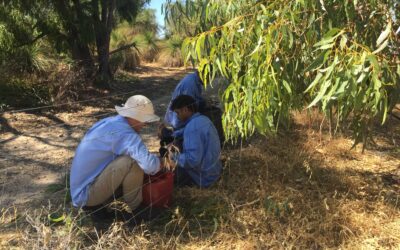
Soils and landforms are the fundamental resources which shape wetlands and waterways, biodiversity and land use, especially agriculture. Agricultural production in the Catchment is worth $469.974 million per annum (source 2021 REMPLAN) and relies directly on the health and conservation of soil resources. Soils should be managed as a living resource with consideration to soil acidity, dryland salinity, prevention of erosion and discharge of sediment.
Biosecurity is an issue of significant concern to the community and is included under this goal given its impact on soils, productivity and biodiversity. Issues such as water repellence and compaction of soils may also be having an impact on farm productivity levels, although the impact on productivity is not clearly understood. Healthy soils will reduce the loss of topsoil to waterways and the impact of sediment on rivers and the Estuary.
Strategies under this goal aim to assist farmers and land managers to better understand their local soils, make informed decisions on soil management practices, and support biosecurity programs. Farmers own and manage over 50% of the Region, making their increased participation in NRM essential. |
| B2.1 |
Understand soil characteristics and risks |
| B2.1.1 |
Support land managers to undertake and understand risk/soil mapping at a local level |
| B2.1.2 |
Support and share research and information that improves our collective understanding of soil characteristics and their productive potential |
| B2.1.3 |
Support land managers to understand the consequences over use of fertilisers, herbicides and pesticides |
| B2.2 |
Support land managers to match land uses and management practices to soil type and land capability |
| B2.2.1 |
Support adaptive land management practices in vulnerable areas |
| B2.2.2 |
Maintain priority areas for agricultural production (while protecting valuable environmental assets) |
| B2.3 |
Support land managers to implement sound soil management practices and use suitable land productively |
| B2.3.1 |
Encourage and support farming methods to enhance soil and soil resilience |
| B2.3.2 |
Encourage use of soil amendments for multiple benefits |
| B2.3.3 |
Support ‘whole of farm’ planning to better meet social, economic and environmental objectives |
| B2.4 |
Support biosecurity practices |
| B2.4.1 |
Support, preparation and implementation of biosecurity program/s for multiple benefits |
| B2.4.2 |
Raise awareness and educate community on local, priority biosecurity issues and provide support for management |
| B2.5 |
Influence legislation and policy |
| B2.1.1 |
Influence and support decision makers in developing policy and legislation for the protection of priority agricultural land |
| B2.1.2 |
Influence and support decision makers in developing policy and legislation for the protection of priority environmental assets |
| B2.1.3 |
Advocate for and support streamlining of planning regulation and licensing for sustainable agricultural practices |
| B3 |
COASTAL AND NEARSHORE AREAS AND PROCESSES ARE RESILIENT AND VALUED |
| Coastal foreshores, beaches and near-shore areas have significant social, ecological and economic values. They support commercial and recreational fisheries, protect coastal residential areas and provide a diversity of habitat for flora and fauna. A key aspect of coastal management in the Region is the network of community groups, local governments and state agencies that manage coastal foreshores and maintain public access to beaches and nearshore waterways. Strategies to achieve this goal are aimed at supporting the groups and organisations who are undertaking coastal area and near-shore management. |
| B3.1 |
Protect foreshores for their ecological and recreational values |
| B3.1.1 |
Encourage/support foreshore management that enables natural process and resilience to a changing climate |
| B3.1.2 |
Support the community to value and manage coastal areas |
| B3.1.3 |
Support recreational uses consistent with environmental protection |
| B3.2 |
Protect near-shore habitats for productivity and biodiversity |
| B3.2.1 |
Support actions/activities to protect near-shore habitats for ecological, recreational and commercial productivity |
| B4 |
BIODIVERSITY IS CONSERVED |
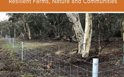
| Biodiversity is the term used to describe the natural diversity of life. This diversity exists at the ecosystem, species and genetic levels. The Region is recognised as a global biodiversity hotspot because of its mega-diverse and unique biodiversity and the level of threat this biodiversity is under. Biodiversity is most effectively and efficiently conserved by protecting natural areas, these being areas of bushland, forest, woodland, waterway, wetland, dune, rock outcrop, foreshore and any other area in a near-nature state. The Region is home to many globally significant natural areas, notable examples being Dryandra Woodland, our Northern Jarrah forest, and the Peel-Yalgorup Ramsar System. The strategies to achieve this goal are focused on protecting priority natural areas, managing and reducing threats to biodiversity assets, and restoring ecological linkages between significant natural areas. Assisting local governments to implement local biodiversity strategies will be one of a number of ways of achieving this goal. |
| B4.1 |
Protect priority terrestrial and aquatic natural areas |
| B4.1.1 |
Influence land-use planning to afford protection to priority natural areas |
| B4.1.2 |
Undertake assessments of biodiversity status |
| B4.1.3 |
Assist land managers to protect priority terrestrial natural areas |
| B4.1.4 |
Assist land managers to protect priority aquatic natural areas |
| B4.1.5 |
Assist land managers to improve biodiversity through regenerative agricultural practices |
| B4.1.6 |
Incorporate knowledge of impacts of changing weather patterns into biodiversity programs |
| B4.2 |
Manage and reduce threats |
| B4.2.1 |
Identify, monitor and communicate threats and threatening processes |
| B4.2.2 |
Implement and support threat reduction activities in priority areas, including managing feral animals, weeds and disease, fire, extreme events and drought |
| B4.2.3 |
Implement and support management and response planning for extreme natural events |
| B4.3 |
Restore ecological linkages |
| B4.3.1 |
Facilitate and/or support collaborative landscape scale restoration for multiple benefits |
| B4.3.2 |
Encourage restoration processes being identified and embedded into the land-use planning system |
| B5 |
WATER RESOURCES ARE MANAGED AND USED WISELY |
Water resources are essential to life. They shape our wetlands, waterways and biodiversity and influence the type and location of agricultural production. Water resources include both surface waters and groundwater, and the aquifer systems that link them both. Most of the forested areas of the Forest and Scarp Subsystem are proclaimed water supply catchments (Land Assessment, 2005).
Water resources are managed under a regime which recognises both public and private use values as well as environmental water requirements. The strategies to achieve this goal support water allocation planning and other activities to ensure the wise use of resources for protection of ecosystems in the long term. These strategies complement the Department of Water’s role in water allocation planning. |
| B5.1 |
Support water allocation planning and management for wise use |
| B5.1.1 |
Undertake a water audit across the catchment to assist in water management in the long term |
| B5.1.2 |
Encourage adequate environment water allocations in and for all priority systems |
| B5.1.3 |
Support measuring and assessment of water supply systems, for environment and agriculture |
| B5.1.4 |
Support the development of water storage facilities for fire management |
| B5.2 |
Support land managers to manage water resources—for multiple benefits |
| B5.2.1 |
Support resource and land managers to assess and implement water capture, harvesting and storage facilities |
| B5.2.2 |
Support resource users to implement water efficiencies |
| B5.2.3 |
Support adaptive management systems to respond to reduced rainfall |