
While this has been one of our most challenging projects ever, we are now nearing the culmination of the construction phase! There is now a weir and Swale inlet culverts on the Peel Main Drain ready to divert flows into the Swales.
Modifications to the Swales to monitor the science of nutrient retention in clay soils have been designed and the contractor will start earthworks soon. All works to the Swales and weir are expected to be complete by mid-April 2021.
Full operation of the system will need to wait until winter flows begin, which is expected in early July 2021. The operation consists of diverting water from of Peel Main Drain into the Swales, feeding the water at different flow rates into each of the six 220m long channels where the water will sit and interact with the clay floor (with any grass removed), before flowing back out into the Peel Main Drain.
Monitoring includes flow measurement in Peel Main Drain and each individual Swale, as well as water quality (WQ) of water entering the Swales and the WQ as it leaves to determine any change.
The Peel Main Drain (MD) Swales project [Peel Main Drain Swales ─ Off-line water treatment pilot project] is a sub-project of the Regional Estuaries Initiative, a State Government Royalties for Regions program. The project is managed by the Peel Harvey Catchment Council (PHCC) and delivered collaboratively with the Department of Water and Environmental Regulation (DWER). The Water Corporation are also key partners in the project and have funded, designed and built the diversion weir and inlet/outlet culverts as well as providing funding for the access road to the infrastructure.
The project involves diverting water from the Peel MD into a series of six Swales adjacent to the drain where the diverted water will be treated before being either feed back into the Peel MD or potentially through wetlands in a future phase of the project.
Peel Main Drain works
The design of the diversion weir (Figure 1) with the associated inlet and outlet pipework was undertaken by David Wills and Assoc with its fabrication and construction undertaken by Ultimate Drainage for the Water Corporation.
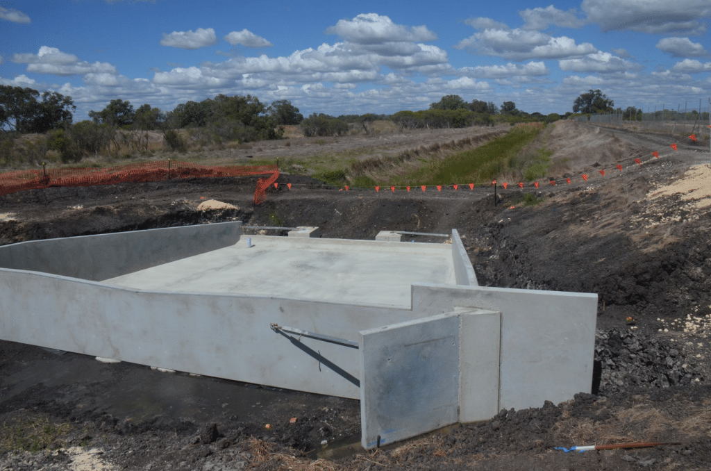
As at the end of March 2021, the construction of the diversion weir is almost complete with the structure only needing backfilling, stone pitching and an access platform to be installed. The downstream outlet culverts of the Swales into Peel MD have also been complete. These consist of three 600mm concrete pipes through the embankment with non-return flaps on the culverts to prevent flow from Peel MD entering the Swales.
Immediately upstream of the weir is a 750mm inlet pipe to feed water into the Swales system from the Peel MD. This inlet has a Penstock that will allow control of how much water enters the Headwater Pool of the Swales. Further upstream of the inlet there will be a water level monitoring ‘floatwell’ which will contain instrumentation to record water levels in the drain and hence allow the water flow-rate over the weir to be derived. All works on the Peel MD managed by Water Corporation are due for completion by 16 April 2021.
Swale works
Peel-Harvey Catchment Council are modifying the existing Swales to monitor water flows, velocity, detention time, and water depth. This information is intended to allow the science behind retention of phosphorous in clays to be quantified. The original Swales were complete in March 2019 and during their construction an all-weather access road from Karnup Road to the Swales was built. Their original configuration was steeply sloping and in trials mobilised a considerable amount of sediment (Figure 2).
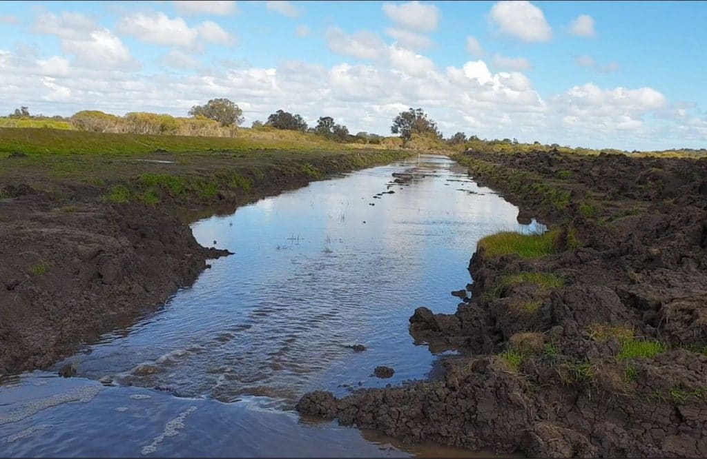
The modified design of the Swales was undertaken by PHCC’s Peter Muirden with support from DWER’s Brad Degens. The new design was approved by the Regional Estuaries Initiative Steering committee in May 2020. The modified design of the Swales now includes five Swales which will be completely ‘flat’ and one Swale left with its exiting slope of 1:500 with a sedimentation sump at its outlet. The length of each Swale is 220m with a width of 13m. The ‘flat’ Swales will allow assessment of the behaviour of a constant depth of water over the 220m length at different water velocities and detention times. For the winter of 2021, a depth of 3cm is proposed on all of the ‘flat’ Swales with flow rates varying from 80L/s down to 0.5L/s. Stopboards will be placed on each of the upstream box culverts shown in Figure 3 to control the flow rates. Figure 3 shows the grass that has grown on the floor and embankment of the Swales over the past two years, and which has now been removed in the modification process.
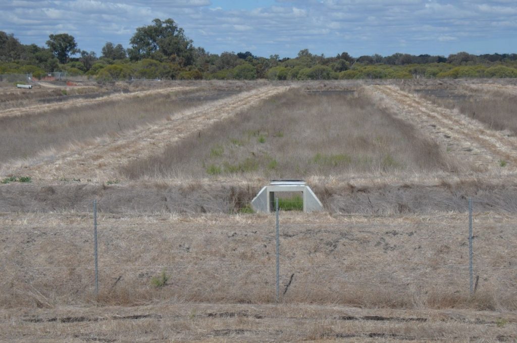
At the outlet of each of the ‘flat’ Swales (Figure 4), will be a box culvert to control outflow of each Swale (and each will have a levee on each side to ensure water only flows out through the culvert). The culverts will have stopboards mounted to maintain water level depth in each Swale and water will flow over the stopboards and back out to Peel MD via the Tailwater Pool.
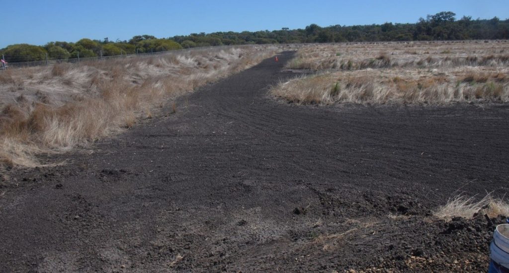
Construction of the Swale modifications are expected to be complete by mid April 2021 with the operation of the WL monitoring in Peel MD being complete and operational by the end of April.
Operation
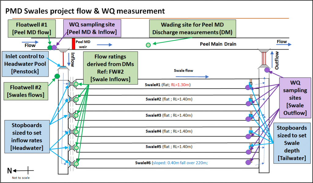
A schematic diagram of the Peel MD Swales is shown in Figure 5 and for its first year, operation is expected to occur during the period July to October 2021. Flow is not expected to flow through the Swales before July 2021 although flow will occur along Peel MD and over the weir from mid April 2021.
Winter flow in Peel MD (in excess of 150L/s) is expected to start between 09 June to 20 July in any year. At the tail-end of the year, flow drops below 150L/s any time between 27 Sept and 17 Nov. Hence, we will have enough water to be able to operate the Swales for three to five months.
The following summarises the operational procedures of the modified Swales which will allow the science behind the system to be quantified:
- Water will flow into the Swales from Peel MD when it banks-up behind the weir.
- Water level (WL) in Peel MD will be recorded at Floatwell #1 which will allow the flow-rate over the weir and along Peel MD to be derived. Sampling for Water Quality (WQ) will also occur here to define the concentrations of WQ parameters of the inflow into the Swales.
- Inflow to the Headwater Pool is controlled by a Penstock at the inlet culvert.
- A set of six culverts with stopboards on their front will control the various flow-rates into and along the Swales. Each stopboard has a different shape and level allowing different flows to be set. Based on the stopboard, the WL in the Headwater Pool will control the amount of water entering each swale and this WL will be recorded at Floatwell #2.
- Each Swale #1 to #5 is ‘flat’ and the depth of water will be set via the downstream outlet control.
- The outlet of each Swale has a box culvert 1200 x 450 that allows a stopboard to be mounted to it. There is also a levee on either side of the culvert to divert all water through the culvert and allow walking over its top access to the downstream ends of all Swales to enable WQ sampling.
- After the water passes through the Swale outlet culverts, it collects in the Tailwater Pool before flowing out into Peel MD again. Non-return flaps on the culverts to Peel MD prevent backflow from the Drain at times of high water level.
- Data collected at the Swales is expected to be stored on the DWER Water Information System over the project life.
- Results from the monitoring are expected to be continuously analysed to ensure the system is working as expected and a full report will be completed in late 2021.
Operation of the Peel MD Swales system is expected to be for a period of five years with subsequent years having the potential to allow quantification of different water depths and treatment options.
This project is part of the Regional Estuaries Initiative and is supported by the State Government’s Royalties for Regions program. #WAEstuaries
